Cullen to Findlater Castle (and back) – approximately 5 miles round trip
Trail Date: February 13, 2023
Method of travel: hike

Walking from Cullen to Findlater Castle (and back) is a great way to spend a sunny afternoon. I unknowingly timed my walk so that I would arrive at Sunnyside Beach at sunset, something I now highly recommend.

This is a very leisurely walk that follows the water’s edge. Cullen has tons of amenities, including free public toilets in the town center and at the beach near the golf course. You can stock up on snacks at one of the shops before hitting the trail. There’s lots of free parking, but the closest spot to the trail would be the east end of the harbour near the Cullen Sea School.

As you leave Cullen, the path is wide and well maintained with finely crushed stone under foot. I saw many elderly folk walking as well as people with strollers (prams) and even someone in a wheelchair. So this section of the trail is considered accessible to all levels.
Soon (about .5 miles) you’ll round the bend and head up a small hill. At this point you can circle back to the upper trail which takes you through the Cullen Bay Caravan park before heading into town. This upper trial also offers some a good viewpoint of the bay.

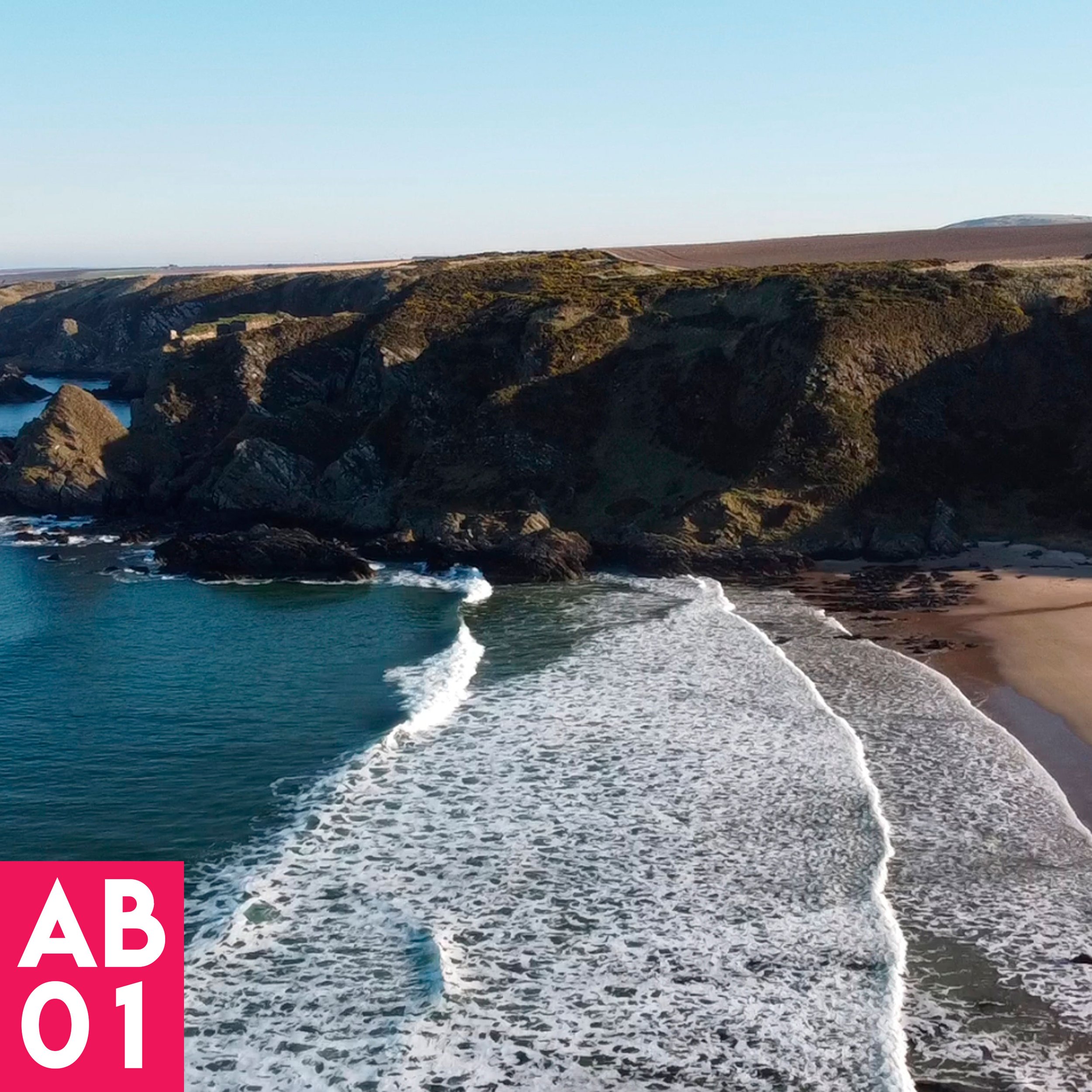
Continue past the Salmon Bothy picnic area and walk along the rocky beach. This is where the trail turns sandy, rocky, and sometimes boggy. It’s no longer suitable for wheels.


The path soon starts climbing along the cliff face, and after about 1.2 miles you’ll be at Logie Head, a steep, narrow and precarious section of trail with beautiful views.


The trail steeply rises and falls along the promontory’s edge (Logie Head) until it descends down the Giant’s Steps. I didn’t know it until my return trip, but these steps were build single-handed by Tony Hetherington in 1987 without any machinery. Quite the feat and well appreciated!
This is also an area of geological interest, with exposed sandstone crags that are popular among rock climbers. But as an artist I found beauty there with my feet planted firmly on the ground. The colors and patterns visible in the stone were breathtaking.


Continuing on down another rocky beach, you’ll hear loud chattering from the nesting seabirds on the vast cliff face to your right.
After about 1.5 miles, the path rounds another promontory and at least you catch a glimpse of Sunnyside Beach and the massive cliffs beyond which are home to Findlater Castle. A keen eye (or zoom lens) can see Findlater perched precariously on the edge of a cliff in the distance.

But before you reach the beach, there is an often boggy path that hugs the rocky shore, and passes the infamous “Charlie’s Cave.” Apparently a French deserter built a hut from driftwood against the rocky outcrop and lived there for over 10 years before being forced to leave. So it’s not quite a cave as much as it’s a…rock. But quirky and interesting nonetheless.

I arrived at Sunnyside beach close to sunset, which was stunning. As the sun dipped behind the hills, long golden rays illuminated the tips of the marram grass. The waves glistened turquoise in the intense sun, made ever brighter in front of the shadowed cliffs beyond. The air was heavy with mist and fishing gulls. It was the perfect spot for a snack while admiring the view.


From Sunnyside beach you can continue east up a sandy path to the top of the cliffs where it soon meets Findlater Castle viewpoint. I’ve walked that path a few times, but we’ll save the Findlater castle magic for the next episode.


On this day, I was eager to avoid being on the trail at dark, so I packed up my snacks and headed back towards Cullen, retracing my steps. I stopped at Logie Head for a quick sketch. The funny thing about cliffs is that they block the sunlight. So while it seemed dark at Sunnyside beach, in the shadow of the cliffs, by the time I was near Cullen I still had plenty of daylight for a quick sketch.


I took my time the rest of the way, enjoying the beautiful light and watching the fishing birds.

I decided to end the day at Cullen Beach, a favorite spot of mine for photography and painting. The setting sun cast a beautiful glow across the sand, and the rhythmic waves could have lulled me to sleep.

Watch Episode 01 of Aberdeenshire Coastal Trail: